File:Frstrackplan.jpg
Jump to navigation
Jump to search

No higher resolution available.
Frstrackplan.jpg (450 × 550 pixels, file size: 23 KB, MIME type: image/jpeg)
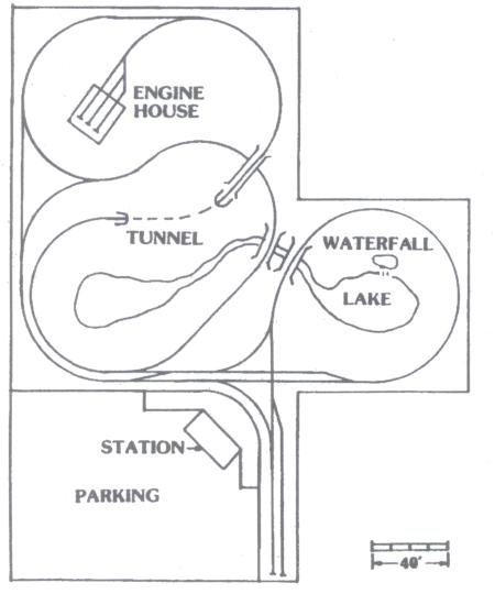
Track plan for the original Flat River and Southern. The waterfall was 15 feet high, and grades exceeded 3% with curves as tight as 35'. From http://www.moosevalley.org/dsn/history/dsnhistory.htm
File history
Click on a date/time to view the file as it appeared at that time.
| Date/Time | Thumbnail | Dimensions | User | Comment | |
|---|---|---|---|---|---|
| current | 22:18, 16 May 2013 | | 450 × 550 (23 KB) | Dnevil (talk | contribs) | Track plan for the original Flat River and Southern. The waterfall was 15 feet high, and grades exceeded 3% with curves as tight as 35'. From http://www.moosevalley.org/dsn/history/dsnhistory.htm |
You cannot overwrite this file.
File usage
The following page uses this file: