File:BrowningPlantation Google TrackPlan merge 20151026.png
Jump to navigation
Jump to search

Size of this preview: 524 × 599 pixels. Other resolution: 957 × 1,094 pixels.
Original file (957 × 1,094 pixels, file size: 1.42 MB, MIME type: image/png)
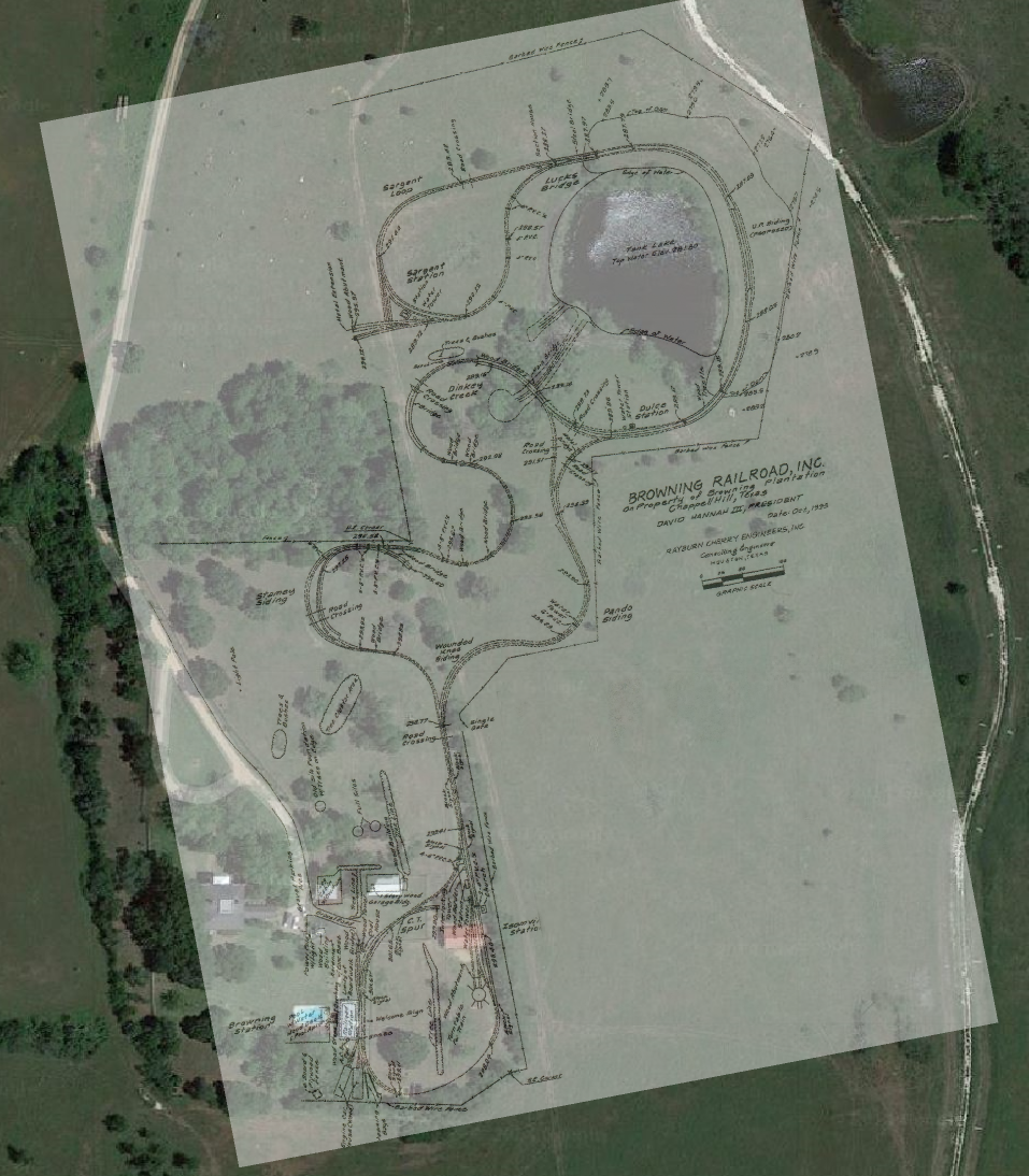
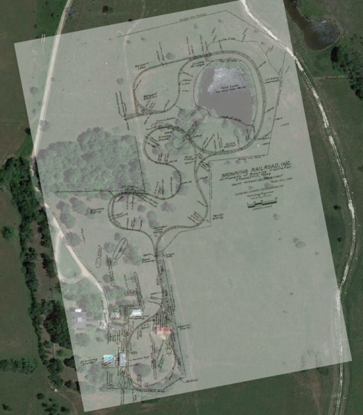
Browning Railroad track plan, 1996, merged onto Google satellite view of Browning Plantation, October 2015.
File history
Click on a date/time to view the file as it appeared at that time.
| Date/Time | Thumbnail | Dimensions | User | Comment | |
|---|---|---|---|---|---|
| current | 16:42, 26 October 2015 | | 957 × 1,094 (1.42 MB) | Dnevil (talk | contribs) | Browning Railroad track plan, 1996, merged onto Google satellite view of Browning Plantation, October 2015. |
You cannot overwrite this file.
File usage
The following page uses this file: